
Route by ExportMyMap
Blue Mountains: 3-Day Itinerary
8 places
Begin around Katoomba and the Three Sisters, then give Wentworth Falls and the Grand Canyon walk their own days. These mountain outings leave room for changing weather and a slower walking pace.
- Make your own copy without signing in: move stops between days and add or remove places from the list.
- Open places or daily routes in Google Maps when you need them.
- Print your itinerary or download a PDF to take with you.
Showing 6 of 6
Day 1: Katoomba
4 stops- 1
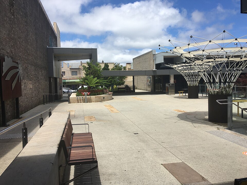
Katoomba
Town
Australia
Katoomba is a mountain town with rail connections, shops and cafés near the Blue Mountains’ best-known valley viewpoints.
View in Google Maps - 2
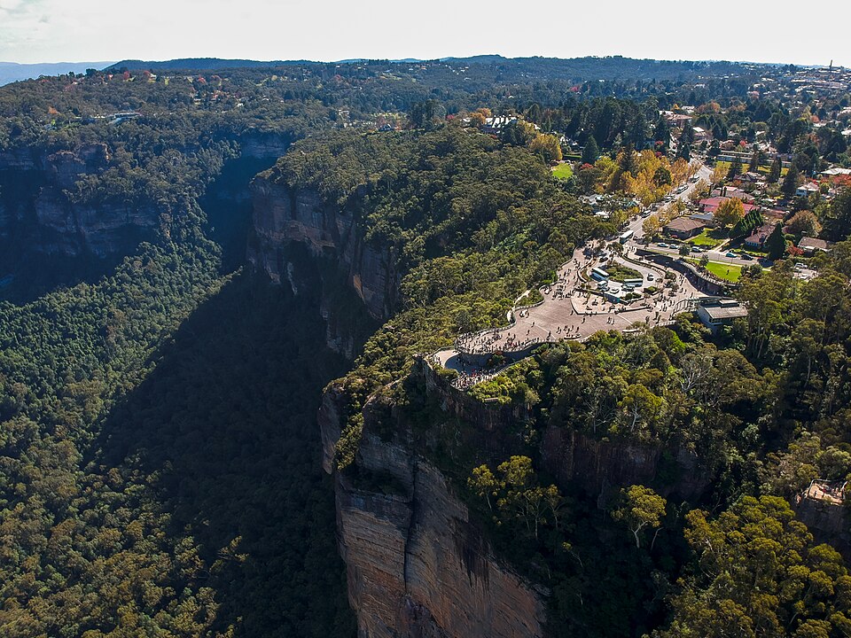
Echo Point Lookout
Viewpoint
Australia
This Katoomba lookout faces the Three Sisters and the broad Jamison Valley, making the mountain landscape easy to take in.
View in Google Maps - 3
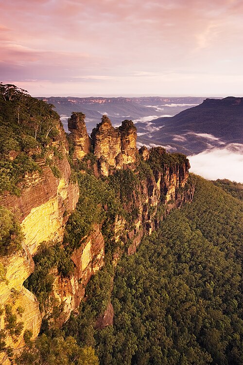
Three Sisters
Landmark
Australia
Three sandstone towers rise above the Jamison Valley near Katoomba, with close views from the Echo Point area.
View in Google Maps - 4
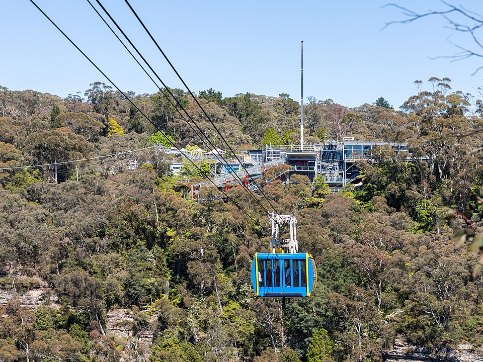
Scenic World
Theme park
Australia
A scenic railway and cableway connect clifftop views with rainforest walks in the Jamison Valley below Katoomba.
View in Google Maps
Day 2: Wentworth Falls
1 stop- 1
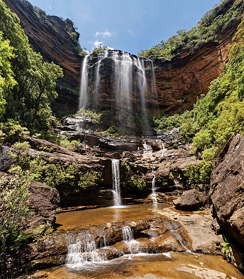
Wentworth Falls
Waterfall
Australia
This tiered waterfall drops toward the Jamison Valley. Surrounding walking tracks provide different viewpoints over the falls and sandstone cliffs.
View in Google Maps
Day 3: Grand Canyon Walking Track
1 stopAllow a separate walking day and check park alerts. The canyon should not be entered before, during or after heavy rain.
- 1
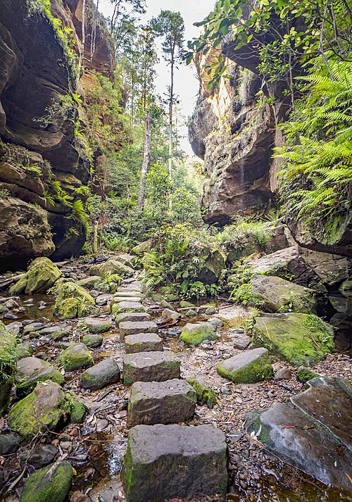
Grand Canyon Walking Track
Scenic route
Australia
A loop near Blackheath descends through sandstone walls, ferns and creek crossings. Reserve a substantial walking block for the canyon circuit.
View in Google Maps
Photo credits & sources
Independent place information and licensed photographs. Opening Google Maps is optional. Content checked: 2026-10-09.
Blue Mountains National Park
Blue Mountains National Park (AU), Three Sisters -- 2019 -- 1987-9.jpg — Dietmar Rabich · CC BY-SA 4.0 · Resized by Wikimedia Commons; no other edits.
Three Sisters
Three Sisters Sunset.jpg — JJ Harrison ( https://www.jjharrison.com.au/ ) · CC BY-SA 3.0 · Resized by Wikimedia Commons; no other edits.
Scenic World
Katoomba (AU), Scenic World, Scenic Skyway -- 2019 -- 1872.jpg — Dietmar Rabich · CC BY-SA 4.0 · Resized by Wikimedia Commons; no other edits.
Wentworth Falls
Upper Wentworth Falls 3, NSW, Australia - Nov 2008.jpg — Diliff · CC BY-SA 3.0 · Resized by Wikimedia Commons; no other edits.
Echo Point Lookout
2019-04-19 Echo Point, Blue Mountains, NSW.jpg — Maksym Kozlenko · CC BY-SA 4.0 · Resized by Wikimedia Commons; no other edits.
Katoomba
Civic Place, Katoomba.jpg — MrMosely · CC0 · Resized by Wikimedia Commons; no other edits.
Lincoln’s Rock
Lincoln's Rock Blue Mountains (29987991687).jpg — Theo Crazzolara · CC BY 2.0 · Resized by Wikimedia Commons; no other edits.
Blue Mountains City Council: Lincoln’s Rock access works and temporary closure
Grand Canyon Walking Track
Grand canyon track (50658918323).jpg — Andrea Schaffer from Sydney, Australia · CC BY 2.0 · Resized by Wikimedia Commons; no other edits.