
Route by ExportMyMap
Krabi, Phi Phi & Phang Nga: 5-Day Itinerary
17 places
Limestone cliffs, forest pools and island bays shape this five-day plan around Krabi, Phi Phi and Phang Nga. Keep the days flexible and choose extra islands from the list as your pace allows.
- Make your own copy without signing in: move stops between days and add or remove places from the list.
- Open places or daily routes in Google Maps when you need them.
- Print your itinerary or download a PDF to take with you.
Boat transfers are needed for the islands. Google Maps may not calculate sea crossings. The pins show destinations, not confirmed departure piers.
Showing 13 of 13
Day 1: Railay & Ao Nang
3 stops · ≈ 3.7 km in a straight lineBoat transfer to Railay; walk between its beaches. Arrange transfers separately from the map route.
- 1
Railay Beach
Beach
Thailand
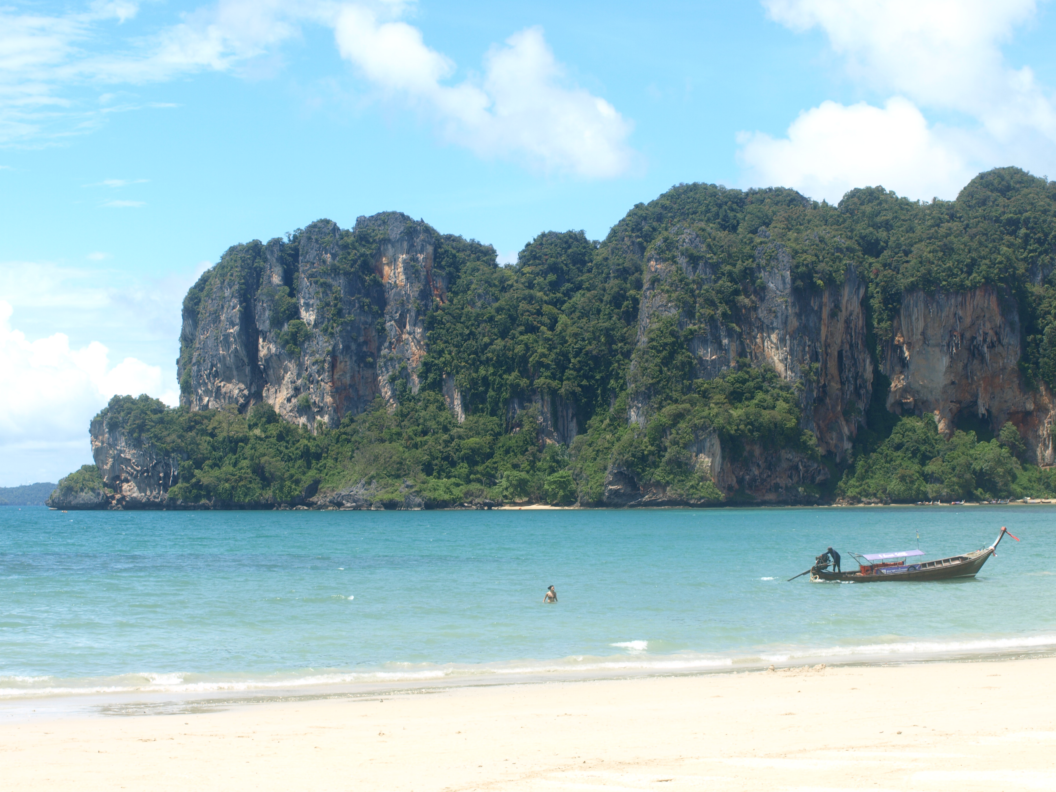
Limestone cliffs frame Railay’s sandy coast on the Andaman Sea. Combine with Phra Nang on the same outing; arrange the boat transfer separately.
View in Google Maps≈ 0.4 km
- 2
Phra Nang Cave Beach
Beach
Thailand
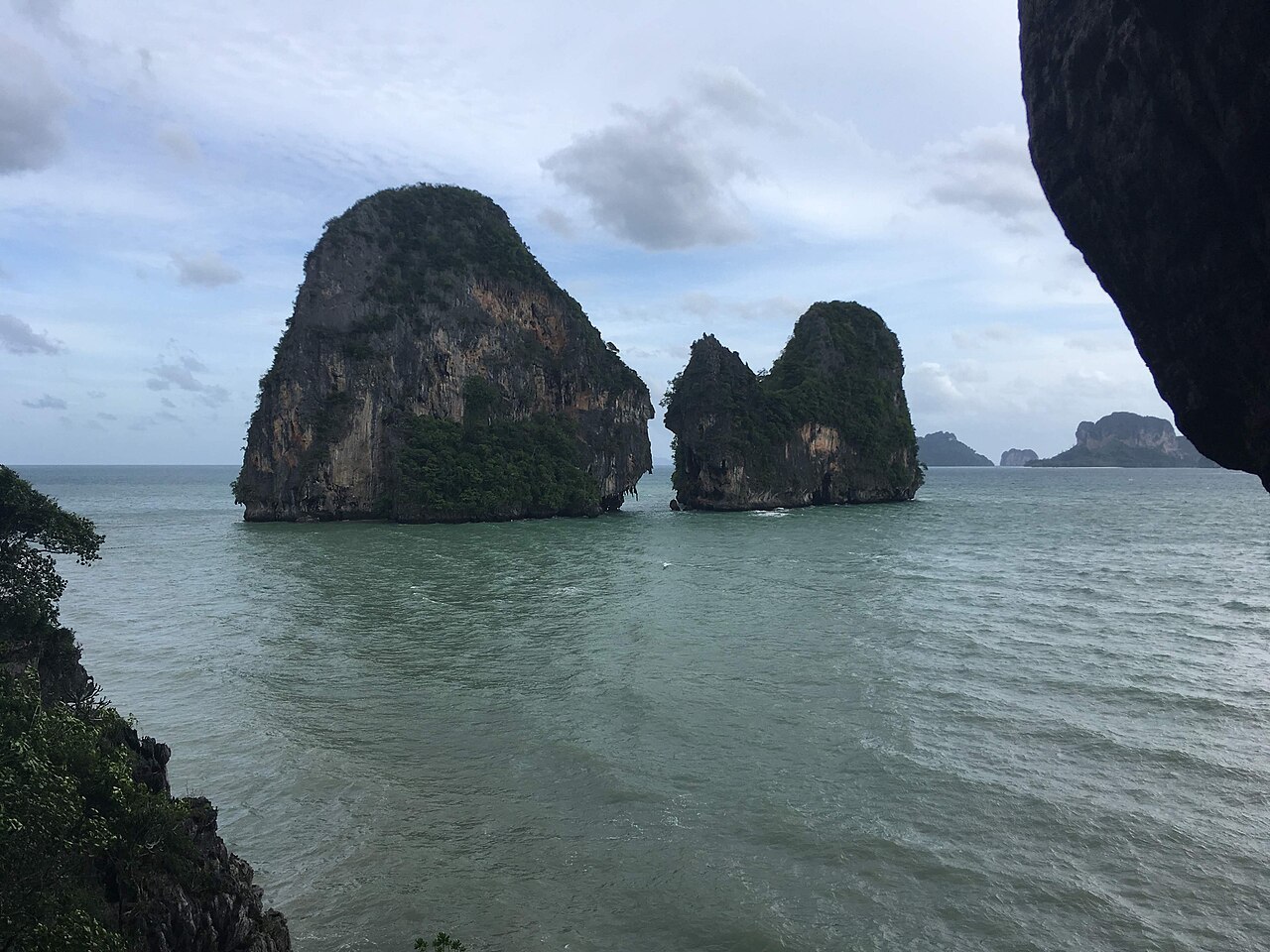
A beach at the southern end of the Railay peninsula, beside limestone cliffs and a cave shrine. Leave time for a walk along the shore and follow local signs around the shrine.
View in Google Maps≈ 3.2 km
- 3
Ao Nang Beach
Beach
Thailand
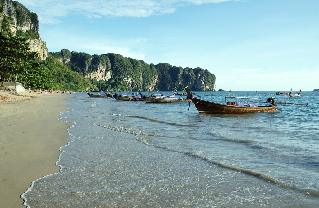
Ao Nang’s main beachfront looks out toward the islands off Krabi. A convenient first or last coastal stop. Confirm the departure point directly with your boat operator.
View in Google Maps
Day 2: Temple & forest pools
2 stops · ≈ 43.8 km in a straight lineA mainland day with a substantial road transfer. Add the hot springs from the list if your pace allows.
- 1
Tiger Cave Temple
Temple
Thailand
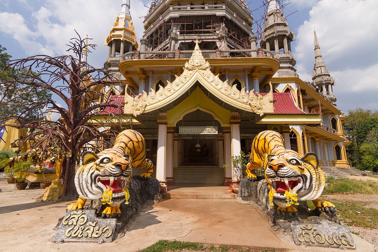
Wat Tham Suea is a Buddhist temple near Krabi, with a hilltop shrine reached by a long staircase. Treat the climb as an optional activity and allow time for the temple grounds.
View in Google Maps≈ 43.8 km
- 2
Emerald Pool
Nature
Thailand
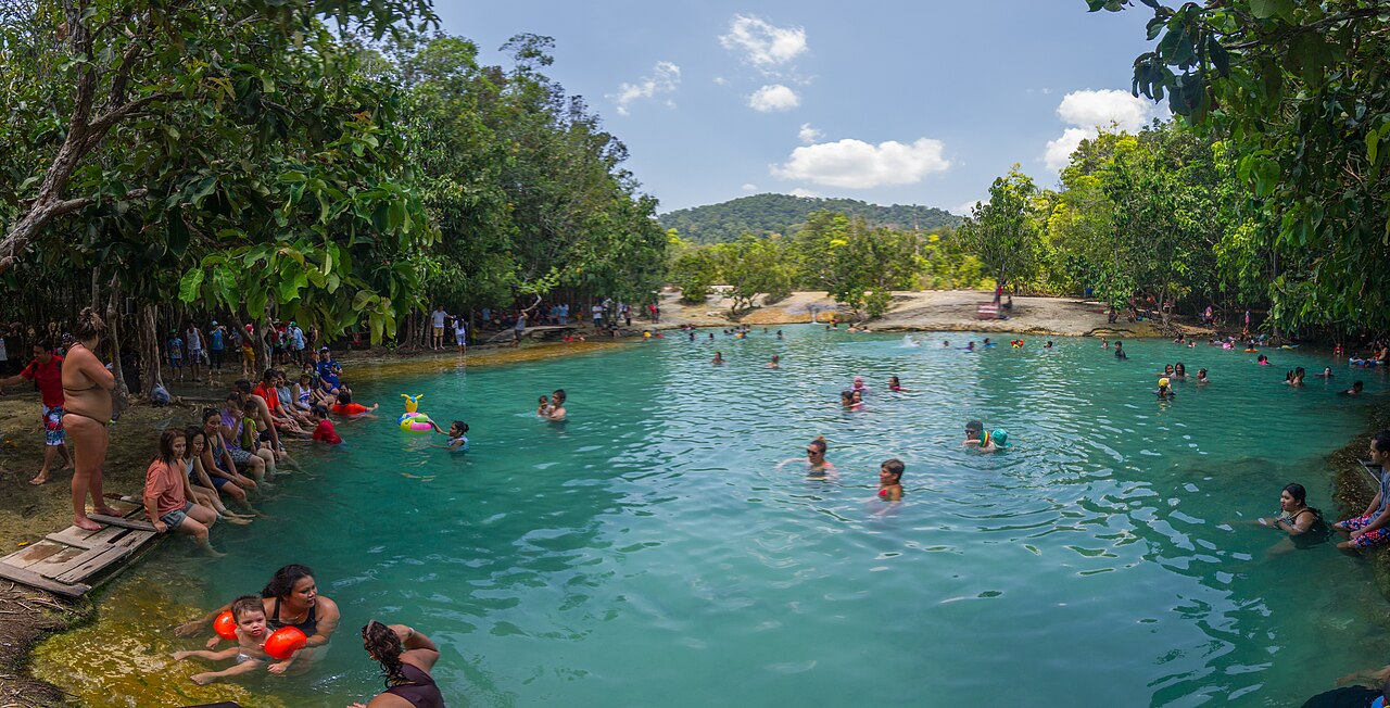
Sa Morakot is a forest pool in the Khao Phra–Bang Khram Wildlife Sanctuary. Keep this as a mainland day. Use the signed paths and check access information before departure.
View in Google Maps
Day 3: Poda, Chicken & Tup
3 stops · ≈ 2.8 km in a straight lineBoat day. Stop order and sandbar access depend on tides, sea conditions and your operator. Google Maps may not provide routes between islands.
- 1
Poda Island
Island
Thailand
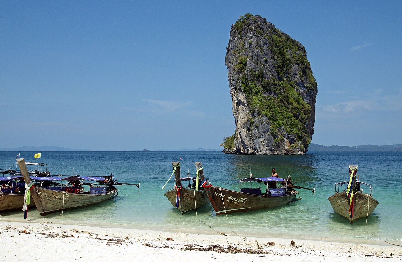
Ko Poda is an island off Ao Nang, with a sandy shore and limestone scenery. Group with Chicken and Tup islands on a boat outing; stop order depends on the operator and conditions.
View in Google Maps≈ 1.9 km
- 2
Chicken Island
Island
Thailand
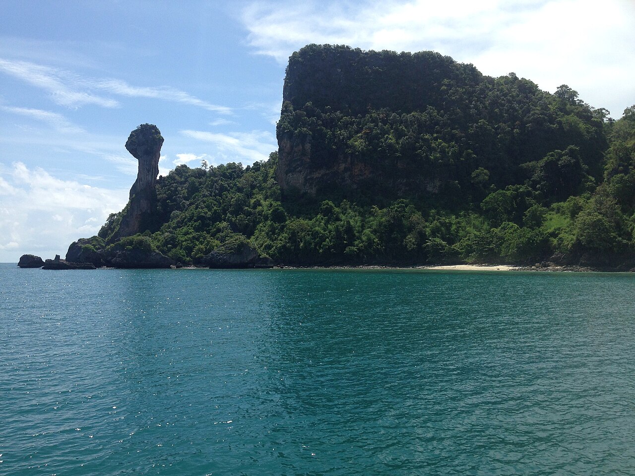
Ko Kai, also called Ko Poda Nok, is part of the island group near Poda and Tup. A stop for the same boat day as Poda and Tup; do not treat the map line as a road connection.
View in Google Maps≈ 1 km
- 3
Tup Island
Island
Thailand
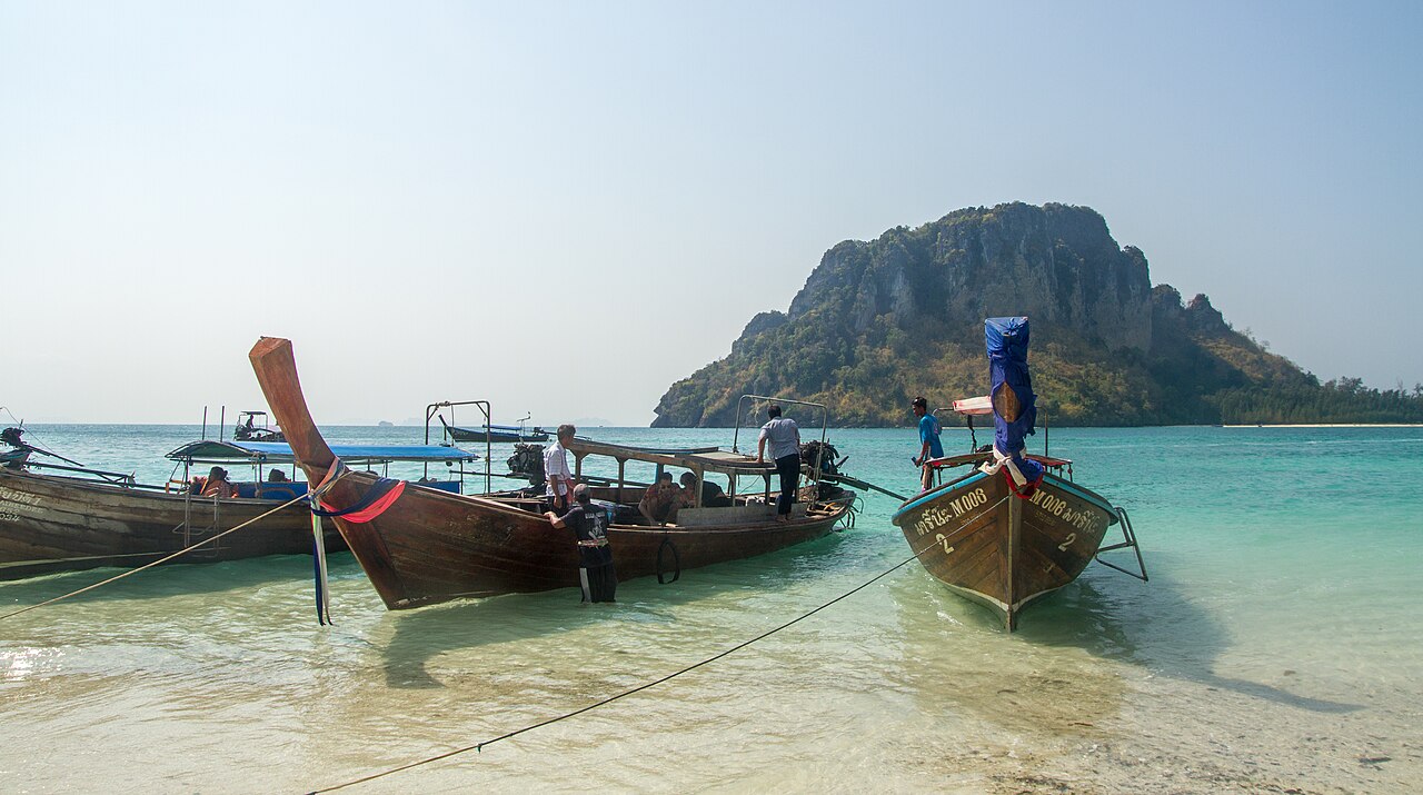
Ko Thap is one of the islands around Thale Waek, where a sandbar appears as the tide recedes. Ask the boat operator about tides. The sandbar is not available for crossing at every water level.
View in Google Maps
Day 4: Phi Phi & its lagoons
3 stops · ≈ 9.1 km in a straight lineBoat day with separately arranged crossings. Confirm Maya Bay access and actual stops before departure; Bamboo Island is an optional extra.
- 1
Phi Phi Don
Island
Thailand
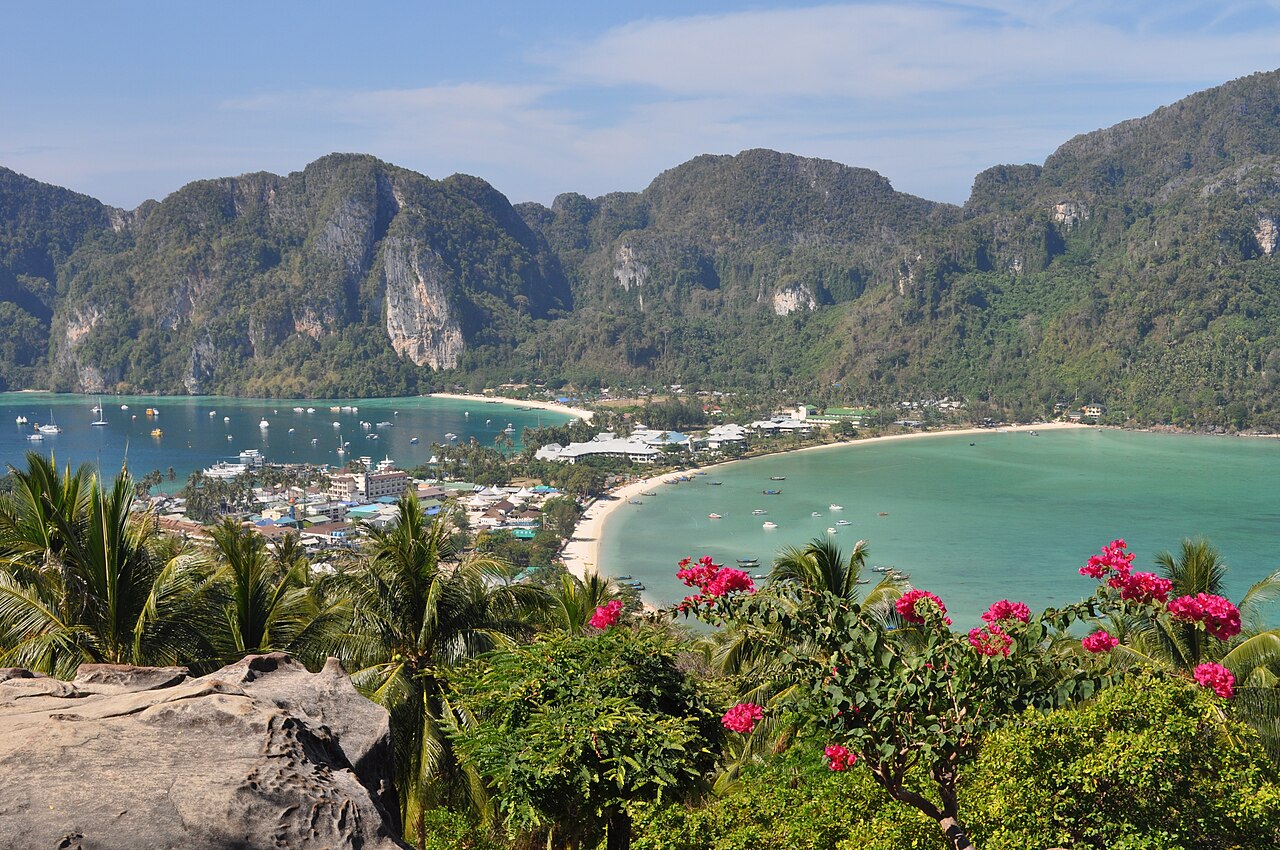
The larger main island of the Phi Phi group has beaches, a village and passenger-boat connections. An island base or a stop on a boat day. The map pin represents the island, not a confirmed arrival pier.
View in Google Maps≈ 7.7 km
- 2
Maya Bay
Beach
Thailand
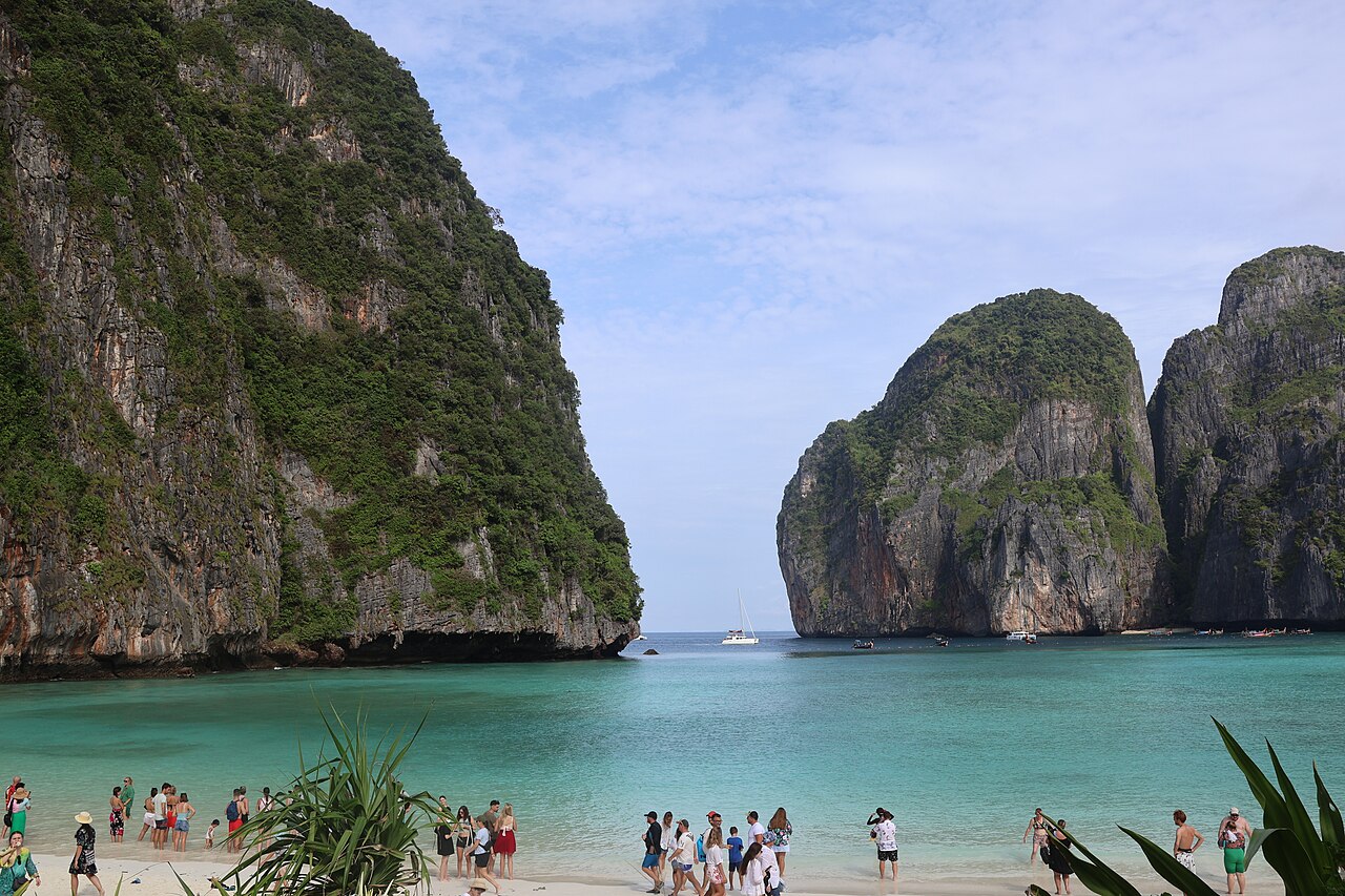
A bay on Ko Phi Phi Le, enclosed by limestone cliffs. Check park access rules and any closures before choosing a date. A saved stop does not confirm entry or swimming access.
View in Google Maps≈ 1.4 km
- 3
Pileh Lagoon
Lagoon
Thailand
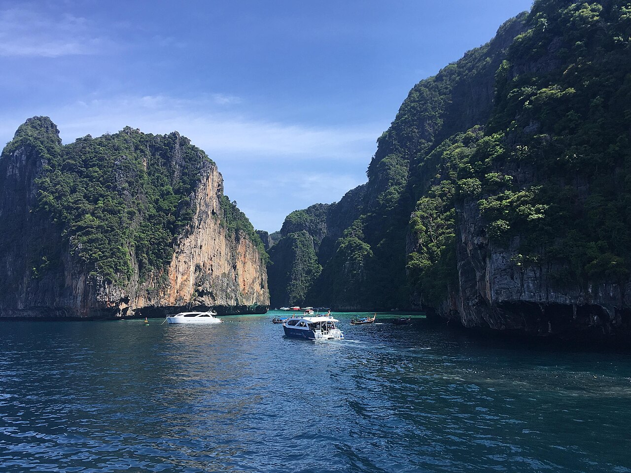
A sheltered lagoon on Ko Phi Phi Le, surrounded by tall limestone walls. Combine with the Phi Phi boat day and confirm the actual stops with your operator.
View in Google Maps
Day 5: Phang Nga viewpoints & islands
2 stops · ≈ 7.9 km in a straight lineCombine a mainland viewpoint with a separately arranged boat trip. The map link is a set of destinations, not a verified boat itinerary.
- 1
Samet Nangshe Viewpoint
Viewpoint
Thailand
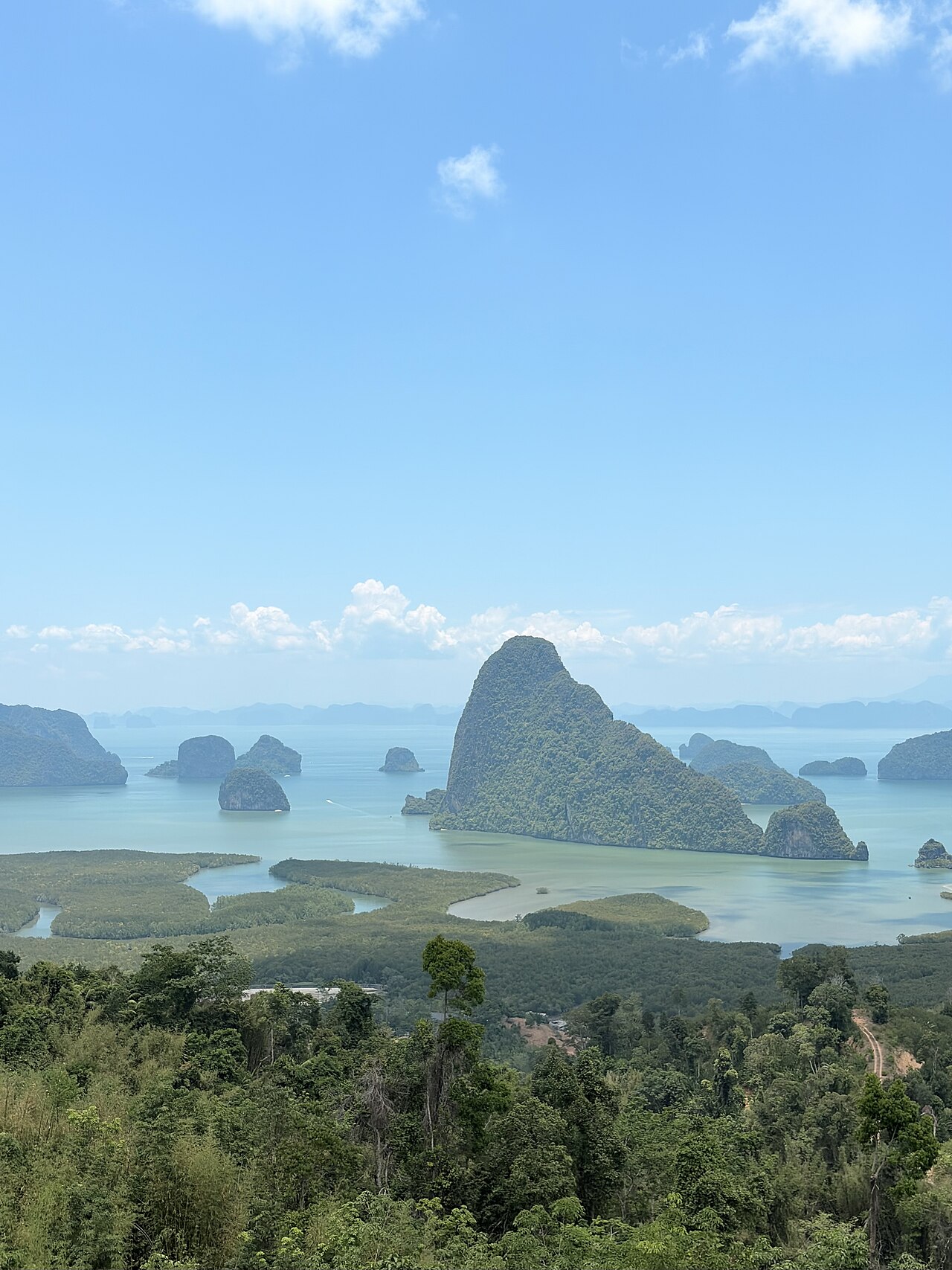
A hillside viewpoint overlooking the islands and mangroves of Phang Nga Bay. Allow a separate mainland transfer. The pin marks the viewpoint area, not parking or a guaranteed vehicle entrance.
View in Google Maps≈ 7.9 km
- 2
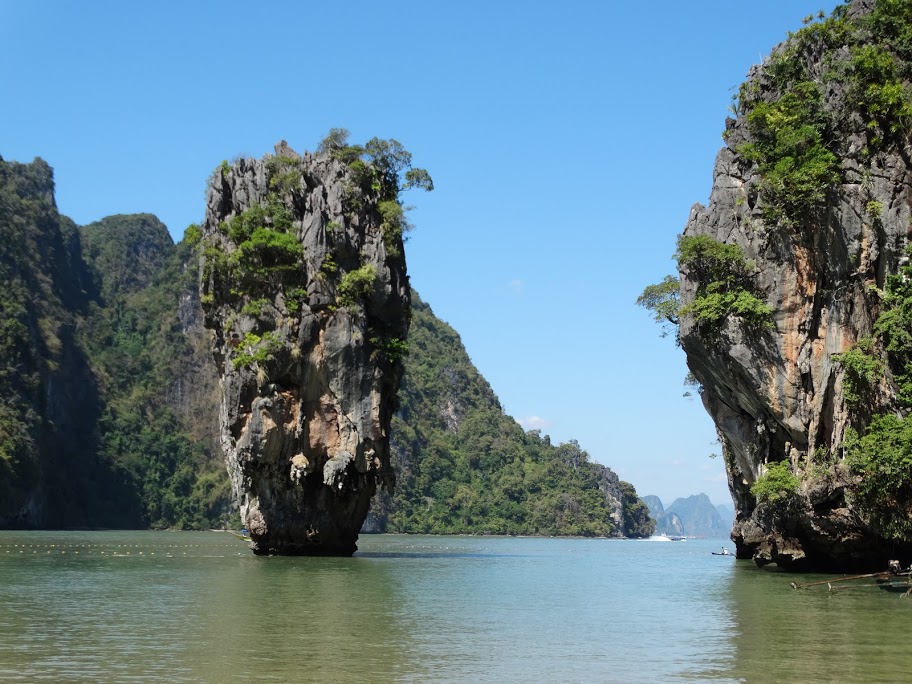
James Bond Island
Island
Thailand
Khao Phing Kan faces the distinctive Ko Tapu limestone stack in Phang Nga Bay. Reach the island by boat. The stop represents Khao Phing Kan and its view of Ko Tapu, not a landing on the stack.
View in Google Maps
Photo credits & sources
Independent place information and licensed photographs. Opening Google Maps is optional. Content checked: 2026-10-09.
Railay Beach
Railay — Wendy Harman · CC BY 2.0 · No edits.
Wikidata: Railay Beach · Tourism Authority of Thailand: 10 Things to Do in Krabi · Wikimedia Commons: photograph identity and license
Phra Nang Cave Beach
Phra Nang Beach 07 — Christophe95 · CC BY-SA 4.0 · Wikimedia thumbnail resized to 1280 px wide; no additional edits.
Wikimedia Commons: documented shoreline viewpoint · Tourism Authority of Thailand: 10 Things to Do in Krabi
Ao Nang Beach
Ao Nang beach — kallerna · CC BY-SA 3.0 · Wikimedia thumbnail resized to 1280 px wide; no additional edits.
Tiger Cave Temple
2016-04-08 Tiger Cave Temple 47 — Maksym Kozlenko · CC BY-SA 4.0 · Wikimedia thumbnail resized to 1280 px wide; no additional edits.
Wikidata: Wat Tham Suea · Tiger Cave Temple: identity and temple layout · Wikimedia Commons: photograph identity and license
Emerald Pool
Emerald Pool (Sa Morakot) — Maksym Kozlenko · CC BY-SA 4.0 · Wikimedia thumbnail resized to 1280 px wide; no additional edits.
Wikidata: Emerald Pool · Tourism Authority of Thailand: 10 Things to Do in Krabi · Wikimedia Commons: photograph identity and license
Klong Thom Hot Springs
น้ำตกร้อน - panoramio — ::::=UT=:::: · CC BY-SA 3.0 · Resized by Wikimedia Commons; no other edits.
OpenStreetMap contributors: Khlong Thom Hot Spring Waterfall (ODbL) · Tourism Authority of Thailand: 10 Things to Do in Krabi
Hong Island
Hong Island (4443109378) — Caitriana Nicholson · CC BY-SA 2.0 · Wikimedia thumbnail resized to 1280 px wide; no additional edits.
Wikidata: Ko Hong, Krabi province · Tourism Authority of Thailand: 10 Things to Do in Krabi · Wikimedia Commons: photograph identity and license
Poda Island
Poda island beach — kallerna · CC BY-SA 3.0 · Wikimedia thumbnail resized to 1280 px wide; no additional edits.
Wikidata: Ko Po Da Nai · Wikimedia Commons: photograph identity and license
Chicken Island
Chicken island 2013-10-14 14-13 — User:Somanyfyqrocket · CC BY-SA 3.0 · Wikimedia thumbnail resized to 1280 px wide; no additional edits.
Wikidata: Ko Po Da Nok · Wikimedia Commons: photograph identity and license
Tup Island
Tup Island, Krabi Province 5 — Maksym Kozlenko · CC BY-SA 4.0 · Wikimedia thumbnail resized to 1280 px wide; no additional edits.
Wikidata: Ko Thap · Tourism Authority of Thailand: 10 Things to Do in Krabi · Wikimedia Commons: photograph identity and license
Phi Phi Don
Phi Phi Don (4415401096) — Kullez · CC BY 2.0 · Wikimedia thumbnail resized to 1280 px wide; no additional edits.
Wikidata: Ko Phi Phi Don · Tourism Authority of Thailand: 10 Things to Do in Krabi · Wikimedia Commons: photograph identity and license
Maya Bay
Plaża Maya Bay — AramilFeraxa · CC BY-SA 4.0 · Wikimedia thumbnail resized to 1280 px wide; no additional edits.
Wikidata: Maya bay · Wikimedia Commons: photograph identity and license
Pileh Lagoon
Pileh Lagoon — Christophe95 · CC BY-SA 4.0 · Wikimedia thumbnail resized to 1280 px wide; no additional edits.
Wikimedia Commons: documented lagoon viewpoint · Tourism Authority of Thailand: 10 Things to Do in Krabi
Bamboo Island
Ko Mai Phai 1 — MarkBA · CC BY-SA 4.0 · Wikimedia thumbnail resized to 1280 px wide; no additional edits.
Wikidata: Ko Mai Phai · Wikimedia Commons: photograph identity and license
James Bond Island
James Bond Island — Leon petrosyan · CC BY-SA 4.0 · Wikimedia thumbnail resized to 1280 px wide; no additional edits.
Wikidata: Khao Phing Kan · Wikimedia Commons: photograph identity and license
Phang Nga Bay
Pang Nga bay — Stéphane Bidouze · CC BY-SA 4.0 · Wikimedia thumbnail resized to 1280 px wide; no additional edits.
Wikidata: Phang Nga Bay · Wikimedia Commons: photograph identity and license
Samet Nangshe Viewpoint
Samet Nangshe Viewpoint — TomMumuPangPangEmma · CC0 · Wikimedia thumbnail resized to 1280 px wide; no additional edits.
Wikimedia Commons: documented Samet Nangshe viewpoint · Tourism Authority of Thailand: Samet Nangshe Viewpoint
Wikidata structured data — CC0 · OpenStreetMap contributors — ODbL (hot-spring location)